The North Atlantic Oscillation and its Effects on Climate and Climate Change

1. Introduction: Defining the North Atlantic Oscillation (NAO)
The North Atlantic Oscillation (NAO) stands as a pivotal mode of climate variability within the North Atlantic region. Its influence extends broadly, shaping weather and climate patterns across continents, from the eastern seaboard of North America, throughout Europe, and even reaching into the vast expanse of northern Asia. Recognized as the most influential atmospheric climate index in the North Atlantic sector, the NAO's behavior is critical for understanding the fluctuations observed in the mid and high Northern latitudes. This report aims to provide a comprehensive analysis of this significant atmospheric phenomenon. It will explore the fundamental definition and underlying mechanisms of the NAO, meticulously examine its impact on weather patterns in both North America and Europe during its distinct positive and negative phases, and investigate its intricate relationship with long-term climate trends. Furthermore, the report will delve into the potential influence of anthropogenic climate change on the NAO, scrutinize its specific effects on the climate of the United Kingdom, including its role in winter storms and temperature variations in Manchester, and analyze its involvement in extreme weather events within the North Atlantic region. Ultimately, this study will synthesize these diverse aspects to offer a holistic understanding of the NAO and its evolving role in a changing climate.
2. The NAO Index and Associated Pressure Patterns
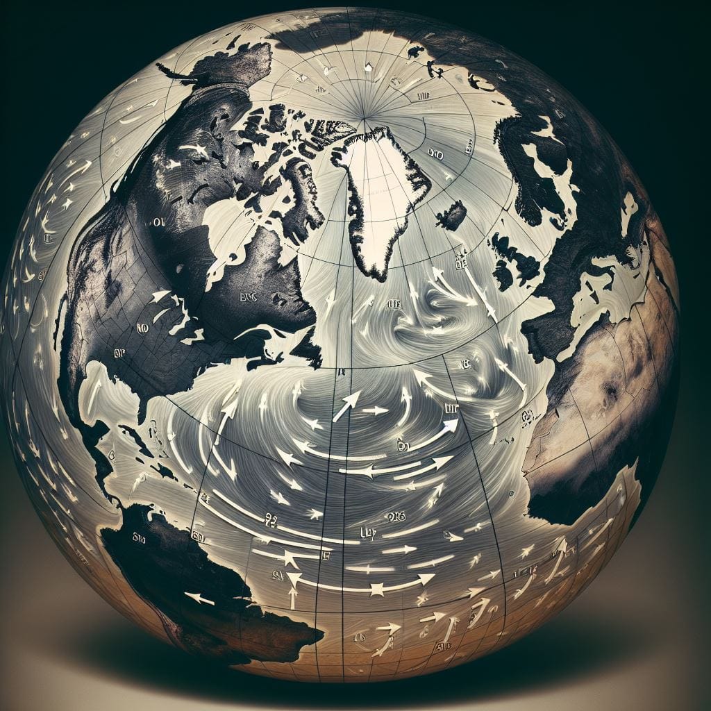
At the heart of understanding the NAO lies its index, a metric that quantifies the oscillation's strength and phase. The North Atlantic Oscillation index describes the fluctuating intensity of two dominant pressure systems that persistently reside over the North Atlantic: a region of low pressure situated near Iceland, known as the Icelandic Low or sub-polar low, and an area of high pressure located near the Azores Islands, referred to as the Azores High or subtropical high. The index is commonly derived by calculating the difference in sea-level pressure recorded at a northern station, such as Reykjavik in Iceland, and a southern station, like Lisbon in Portugal or Ponta Delgada in the Azores. Notably, the National Oceanic and Atmospheric Administration (NOAA) employs a more sophisticated statistical approach, utilizing empirical orthogonal functions (EOFs) applied to sea level pressure data at the 500 millibar atmospheric level to capture the broader pressure pattern across the North Atlantic. A positive NAO index value signifies a greater-than-average pressure difference between these two key regions, while a negative value indicates a pressure difference that is smaller than the long-term average. It is important to recognize that the NAO index is not static; it exhibits considerable variability across seasons and from one year to the next. This quantitative measure of the pressure gradient across the North Atlantic serves as the fundamental driver behind the oscillation's far-reaching influence on weather patterns. While various methods exist for calculating the index, they all converge on the core concept of measuring the relative strength of the Icelandic Low and the Azores High. The strong correlation observed between station-based and EOF-based definitions underscores their ability to capture the same dominant pattern of atmospheric variability.
During the positive phase of the NAO, a distinct pattern of atmospheric pressure emerges. Both the Icelandic Low and the Azores High intensify, becoming stronger than their average strengths. This intensification leads to a notable increase in the pressure difference between these two centers of atmospheric action. Consequently, the jet stream, a high-altitude current of air that steers weather systems, gains strength and shifts its typical path northward. This configuration results in stronger westerly winds prevailing across the North Atlantic. In essence, the positive NAO phase is characterized by significantly elevated surface pressure over the central Atlantic, spanning from the vicinity of Bermuda to Spain, coupled with exceptionally low pressure over Greenland. This amplified pressure difference acts as a powerful atmospheric 'seesaw' , intensifying the typical pressure patterns associated with the Icelandic Low and the Azores High. The enhanced pressure gradient creates a more vigorous atmospheric circulation, marked by the strengthening of westerly winds and the northward displacement of the storm track. This robust westerly flow plays a crucial role in transporting mild, oceanic air masses into the European continent.
Conversely, the negative phase of the NAO is characterized by a weakening of both the Icelandic Low and the Azores High, which become less intense than their average states. This weakening leads to a reduction in the pressure difference between the two pressure centers. The jet stream, in response, loses strength and tends to adopt a more zonal, west-to-east orientation, or may even shift southward from its usual position. As a result, the typically dominant westerly winds across the North Atlantic become weaker, and winds blowing from the east or northeast become more frequent, particularly over Europe. During this negative phase, the area of high pressure in the Atlantic shifts its location, positioning itself much closer to the European landmass. The diminished pressure gradient during the negative NAO phase fosters a less organized and weaker atmospheric circulation, allowing for the emergence of different wind patterns and storm tracks compared to the positive phase. The jet stream's behavior during the negative phase is often described as more meandering , contrasting with the straighter, more direct flow observed during the positive phase. This weaker westerly flow has a direct impact on the movement of air masses, hindering the transport of mild, oceanic air into Europe.
3. Impact of the Positive NAO Phase on Weather Patterns
During the positive phase of the North Atlantic Oscillation, a distinct set of weather patterns unfolds across North America. Typically, the eastern regions of North America experience higher atmospheric pressure. This higher pressure regime is associated with a reduction in the frequency and intensity of cold-air outbreaks originating from the Arctic, leading to milder winter conditions. Furthermore, the increased air pressure often results in decreased storminess in these areas. Warmer temperatures are frequently observed throughout the eastern United States during a positive NAO phase. While the primary impact is on temperature and storm activity, some studies suggest that increased rainfall can also occur in the eastern US during this phase. In contrast, the northwestern Atlantic region, encompassing areas such as Greenland and eastern Canada, tends to experience colder and drier conditions when the NAO is in its positive phase. Specifically, northern Canada is prone to cold and dry winter conditions under these circumstances. The generally more stable and milder winter conditions in the eastern US during a positive NAO are likely a consequence of the northward shift of the jet stream, which effectively acts as a barrier, limiting the southward intrusion of frigid Arctic air. The prevalence of higher pressure systems, characteristic of the positive NAO, further contributes to these stable weather patterns. This northward displacement of the jet stream also means that fewer major storms directly impact the eastern United States.
Across the Atlantic, Europe experiences a different set of impacts during a positive NAO phase. Northern Europe, including the United Kingdom, typically encounters increased storminess and precipitation. This heightened storm activity is often accompanied by warmer-than-average temperatures, attributed to the arrival of air masses originating from lower, more southerly latitudes. Mild and wet winters are a common feature in northern Europe during periods of positive NAO. The dominance of winds from the west, carrying warmer air from the Atlantic, contributes significantly to these conditions. Conversely, southern Europe tends to experience decreased storminess and below-average precipitation during a positive NAO phase. These drier conditions are often accompanied by colder temperatures. The Mediterranean region, in particular, can become colder and drier under the influence of a positive NAO. The strengthened and northward-shifted jet stream, characteristic of the positive NAO, plays a crucial role in directing more storms and warmer, moisture-laden air towards northern Europe. Simultaneously, this shift suppresses storm activity and leads to drier, cooler conditions in the southern parts of the continent. The increased pressure difference between the Azores High and the Icelandic Low is the fundamental driver of these contrasting weather patterns across Europe.
4. Impact of the Negative NAO Phase on Weather Patterns
The negative phase of the North Atlantic Oscillation brings about a contrasting set of weather impacts across North America. Eastern North America typically experiences lower atmospheric pressure. This lower pressure regime is associated with an increased frequency and intensity of cold-air outbreaks from the Arctic, leading to colder and potentially snowier winters. Lower-than-average temperatures are commonly observed in the eastern US during a negative NAO phase. Winters in the mid-latitudes are often cooler than average when the NAO is negative. In contrast, the northwestern Atlantic region, including Greenland and northern Canada, tends to experience milder and wetter conditions during a negative NAO phase. Specifically, northern Canada is more likely to have mild and wet winters under these circumstances. The tendency for colder and stormier winter conditions in the eastern US during a negative NAO is attributed to the greater southward penetration of cold Arctic air. The lower air pressure associated with this phase facilitates these stronger cold-air outbreaks. The weakened and potentially southward-shifted jet stream allows for a less stable polar vortex, increasing the likelihood of cold air masses moving southward. The more west-to-east orientation of the jet stream and storm track during a negative NAO can also lead to increased storminess along the eastern coast of the United States.
Across the Atlantic, Europe experiences a different set of weather anomalies during a negative NAO phase. Northern Europe typically encounters decreased storminess, below-average precipitation, and lower-than-average temperatures. These conditions are often accompanied by easterly winds that bring cold air from the continental interior. Cold, calm, and dry winters are more probable in northern Europe when the NAO is negative. Winds blowing from the east and northeast are more frequent during this phase, bringing with them colder air. Conversely, southern Europe tends to experience increased storminess, above-average precipitation, and warmer-than-average temperatures during a negative NAO phase. The Mediterranean region is also likely to receive abundant winter rainfall when the NAO is negative. The negative NAO phase fosters a more blocked atmospheric pattern over northern Europe, hindering the flow of warm, moist Atlantic air and allowing cold continental air to dominate. Simultaneously, storm tracks are often redirected southward towards southern Europe. The weaker pressure difference between the Azores High and the Icelandic Low during a negative NAO allows for a more west-to-east orientation of the storm track. The prevalence of easterly winds further contributes to the colder temperatures observed in northern Europe during this phase.
5. The NAO and Long-Term Climate Trends
The North Atlantic Oscillation is not merely a short-term weather phenomenon; scientific literature reveals its significant connection to long-term climate trends. The NAO exhibits variability across a wide spectrum of time scales, ranging from the relatively short interannual fluctuations to much longer multidecadal cycles. Notably, the wintertime NAO demonstrates significant variability that spans decades and even multiple decades. This oscillation plays a substantial role in shaping the variability of winter climate specifically within the Atlantic sector. In fact, the impacts of the NAO on winter climate are far-reaching, extending from Florida in North America to Greenland, and from northwestern Africa across Europe and deep into northern Asia. Research conducted by Hurrell in 2008 indicated that the recent upward trend observed in the NAO accounts for a considerable portion of the regional surface warming that has occurred over Europe and Asia. This suggests that changes in atmospheric circulation patterns, such as those embodied by the NAO, can have a significant influence on regional temperature trends. Furthermore, a notable steepening of the NAO gradient has been observed at decadal time scales, particularly since the 1970s. The low-frequency variability originating in the North Atlantic, potentially linked to the NAO, has been shown to have implications for the global climate system. Observational and modeling evidence supports the idea that this long-term variability in the North Atlantic can significantly affect the climate of the entire Northern Hemisphere. The persistent nature of NAO phases over extended periods can lead to cumulative effects on regional climate variables, thereby contributing to these long-term trends. The established correlation between the NAO and Northern Hemisphere temperatures further supports this connection.
Over the past century, the NAO has exhibited notable changes in its behavior. Particularly in the last three decades, starting in the 1990s, there has been a discernible shift in the phase of the NAO, moving from a predominantly negative state towards more frequent positive index values. This trend towards a more positive phase is considered a remarkable event and potentially unprecedented when viewed within the context of the observational record. Some of the most pronounced positive anomalies in the NAO index have been documented since the winter of 1989. This sustained trend has been associated with a variety of climate changes across the Northern Hemisphere, including milder winters in Europe and Asia, more severe winters in eastern Canada, and alterations in regional precipitation patterns and the extent of sea-ice cover. Scientific analysis has also revealed an upward trend in the indices used to measure the NAO over the latter half of the 20th century. This recent upward trend towards more positive NAO index values during winter has been linked to an increase in wave heights over the northeastern Atlantic Ocean. It is also worth noting that the summer expression of the NAO, known as the SNAO, has displayed significant variability over the past century, with a substantial decline in its values observed since the 1970s. This persistent shift towards a positive NAO phase, especially during the winter months, stands out as a dominant feature of recent climate trends in the North Atlantic region, with widespread and significant consequences. The unusual persistence and magnitude of this trend raise important questions about the underlying mechanisms driving these changes in the atmospheric system. The contrasting behavior observed between the winter NAO and the summer SNAO underscores the complex nature of the changes occurring in atmospheric circulation patterns.
6. Anthropogenic Climate Change and the NAO
The potential influence of human-caused climate change on the North Atlantic Oscillation is an area of active scientific investigation. While the NAO is recognized as a natural mode of climate variability, a growing body of research suggests that anthropogenic factors, particularly the increasing concentrations of greenhouse gases in the atmosphere, may be playing a role in shaping its long-term behavior. Most climate models, when simulating the response to rising greenhouse gas levels, project some increase in the winter NAO index. However, it is important to note that the magnitude of these modeled changes is generally smaller than the positive trend that has been observed in the real atmosphere. Natural climate forcings, such as volcanic aerosols, have been shown to induce a positive phase of the NAO in the years following major eruptions, and variations in solar irradiance have also been linked to multidecadal changes in the NAO. Despite these natural influences, the prevailing scientific view is that the recently observed positive trend in the NAO index is most likely attributable to the increasing concentrations of greenhouse gases in the atmosphere. Furthermore, limitations in the way that current climate models represent key atmospheric processes, such as the role of water vapor, can introduce uncertainties in the predictions of the NAO's future behavior. Some studies suggest that under scenarios with very high concentrations of greenhouse gases by the end of the current century, the NAO could potentially reach magnitudes that have never been seen before in historical records. This suggests that while the NAO has inherent natural variability, human activities are increasingly recognized as a potential driver influencing its long-term trajectory, particularly the prominent positive trend observed in recent decades. The precise mechanisms through which anthropogenic forcing affects the NAO, as well as the extent of this influence and the ability of climate models to accurately capture these changes, remain important areas for ongoing research.
Looking towards the future, climate change projections offer insights into potential shifts in the NAO's frequency and intensity. Generally, climate models project an increase in the winter NAO index by the latter part of the 21st century under a scenario of high greenhouse gas emissions. This projected increase in the NAO index is often accompanied by corresponding changes in precipitation patterns across Europe, with an anticipated increase in winter precipitation in northern Europe and a decrease in southern Europe. Furthermore, most climate models suggest that extreme positive NAO winters are likely to become more frequent as a consequence of these changes in the average state of the NAO. These extreme positive NAO winters are also projected to have more significant impacts on precipitation, largely due to the overall changes in average precipitation amounts. Some research indicates the potential for the NAO to reach unprecedented magnitudes by the end of the century, particularly under high-emission scenarios. These future projections suggest a trend towards a more positive and potentially more extreme winter NAO, which could lead to substantial alterations in European winter weather patterns. This includes the likelihood of more frequent and intense periods of mild, wet, and stormy winters in northern Europe, along with potentially more severe consequences from associated extreme weather events.
7. Regional Focus: The NAO and the United Kingdom's Climate
The climate of the United Kingdom is significantly influenced by the North Atlantic Oscillation, particularly during the winter months. The NAO stands as the primary pattern of atmospheric circulation variability over the North Atlantic region, directly impacting the weather experienced across the UK. The strength of the pressure gradient between the Icelandic Low and the Azores High, the defining characteristic of the NAO, plays a crucial role in determining both the intensity and the trajectory of the Atlantic storm track, which in turn has a direct impact on the UK's weather. Historically, the NAO has been strongly linked to instances of winter flooding and significant wind events in the UK. The UK's geographical location renders it particularly susceptible to the influence of the North Atlantic jet stream and the storms it carries, both of which are modulated by the phase and intensity of the NAO. The pressure difference between Iceland and the Azores essentially dictates the strength and direction of these weather systems as they approach the British Isles.
The influence of the NAO on winter storms in the UK is particularly pronounced. During a positive NAO phase in winter, the stronger westerly winds and the more northerly track of storms across the Atlantic lead to mild, stormy, and wet conditions in the UK. Conversely, a negative NAO phase in winter results in weaker westerly winds and a greater frequency of easterly winds, which typically bring less stormy but potentially colder, drier, and even snowy conditions to the UK. Some research suggests that positive NAO winters might be characterized by a higher incidence of wind storms. Projections indicate that unprecedented changes in North Atlantic winds, potentially driven by the NAO, could lead to increased risks of flooding and storm damage in northern Europe, including the UK, in the future. The NAO, therefore, acts as a primary modulator of winter storm activity affecting the UK. A positive phase increases the likelihood of strong, frequent storms and associated flooding, while a negative phase reduces storminess but elevates the risk of cold weather and snowfall. Future increases in the magnitude of the NAO could potentially amplify these impacts.
8. The NAO and Extreme Weather Events in the North Atlantic
The North Atlantic Oscillation plays a crucial role in shaping the occurrence and characteristics of extreme weather events within the North Atlantic region. Scientific research has established that the NAO explains a substantial portion of the climate variability observed across the North Atlantic, and numerous studies have linked its phases to the frequency and intensity of climate extremes, particularly during the winter season. For instance, positive NAO phases have been associated with the occurrence of more severe storms in the North Atlantic. In fact, the positive phase is generally related to warmer and wetter ambient conditions alongside an increased likelihood of severe storms in this region. Changes in the phase and magnitude of the NAO have also been linked to significant alterations in the frequency of extreme winter precipitation events across Europe. Furthermore, the NAO has a strong influence on the frequency of cold weather events observed throughout the extratropical Northern Hemisphere during the January to March period. The impact of the NAO on extreme weather can even extend to seemingly unrelated phenomena; for example, an extreme negative NAO event that occurred in 2010 has been hypothesized to have contributed to an unusual Sargassum bloom in the tropical Atlantic, highlighting the far-reaching consequences of extreme NAO phases. Additionally, a related atmospheric pattern, WEPA, which is associated with the positive phase of the NAO, reflects intensified winds that are often associated with severe storms, many of which track across the United Kingdom. Thus, the NAO stands as a significant driver of extreme weather events in the North Atlantic, influencing the likelihood and severity of storms, extreme precipitation, and temperature anomalies across Europe, and potentially contributing to other environmental phenomena.
The relationship between the NAO and extreme weather events is likely being modified by the ongoing changes in the global climate. Anthropogenic climate change is widely projected to lead to an overall increase in the frequency and intensity of various types of extreme weather events. Projections suggest that potential increases in the magnitude of the NAO, particularly under high greenhouse gas emission scenarios, could result in severe impacts such as heightened risks of flooding and storm damage in northern Europe, including the UK. Changes in the NAO, which themselves may be influenced by climate change, could significantly alter the predictions of future extreme weather events derived from current climate models. The complex interplay between anthropogenic warming trends and natural modes of climate variability like the NAO makes the task of accurately predicting future extreme weather events particularly challenging. It is plausible that climate change could exacerbate the influence of the NAO, leading to more frequent and intense extreme weather events associated with both its positive and negative phases. Therefore, it is crucial to consider the potential modifications to the relationship between the NAO and extreme weather due to anthropogenic climate change when developing future climate projections and adaptation strategies.
9. Synthesis and Conclusion
The North Atlantic Oscillation is a fundamental mode of atmospheric variability in the North Atlantic region, characterized by the seesawing of atmospheric pressure between the Icelandic Low and the Azores High. The NAO index serves as a crucial tool for quantifying the strength and phase of this oscillation, which directly influences the intensity and positioning of the North Atlantic jet stream and associated storm tracks. The distinct positive and negative phases of the NAO lead to contrasting and significant impacts on weather patterns, temperatures, and precipitation across both North America and Europe. Furthermore, the NAO exhibits considerable variability across different time scales, including a notable trend towards a more positive phase observed in recent decades, which has implications for long-term climate trends in the North Atlantic region.
Projections of future climate change indicate that anthropogenic activities, primarily through the emission of greenhouse gases, are likely to influence the NAO. Many climate models suggest a tendency towards a more positive winter NAO in the future. This potential shift could result in more frequent and intense periods of mild, wet, and stormy winters in northern Europe and the United Kingdom, as well as potentially amplifying the impacts of extreme weather events throughout the North Atlantic region. Given the significant influence of the NAO on regional and even hemispheric climate, continued research into its dynamics and its interaction with anthropogenic climate change is of paramount importance for improving the accuracy of future climate predictions and for developing effective adaptation strategies aimed at mitigating the risks associated with future extreme weather events.
Table 1: Typical Weather Impacts of NAO Phases
NAO Phase | North America (Eastern) | Europe (Northern) | Europe (Southern) |
Positive | Milder winters, fewer cold-air outbreaks, decreased storminess | Warmer, wetter, increased storminess | Colder, drier, decreased storminess |
Negative | Colder winters, stronger cold-air outbreaks, increased storminess | Colder, drier, decreased storminess | Warmer, wetter, increased storminess |
Table 2: Observed Changes in NAO Behavior Over the Past Century
Period | Key Observed Changes | Associated Climate Impacts |
Early 20th C | Variability, no strong persistent trend | Variable winter conditions |
Mid-Late 20th C | Shift towards negative phase (e.g., 1960s) | Colder winters in northern Europe |
Late 20th/Early 21st C | Strong trend towards positive phase (since 1990s) | Milder winters in Europe and eastern US, changes in precipitation and sea ice |
Table 3: Projected Impacts of Anthropogenic Climate Change on the NAO
Projection Aspect | Model Findings | Potential Implications |
Mean State | General projection of an increase in the winter NAO index | Tendency towards more positive phase conditions |
Frequency | Increased frequency of extreme positive NAO winters | More frequent periods of mild, wet, and stormy winters in northern Europe |
Intensity | Potential for unprecedented NAO magnitudes under high-emission scenarios | Increased risk of severe impacts from extreme weather events like flooding and storm damage in northern Europe and UK |
Table 4: Influence of NAO Phases on UK Winter Climate
NAO Phase | Winter Storms | Temperature | Precipitation (Northwest UK) | Precipitation (Southeast UK) |
Positive | Stronger, more frequent | Milder | Wetter | Drier |
Negative | Weaker, less frequent | Colder (potentially) | Drier | Wetter |
Works cited
1. Climate Variability: North Atlantic Oscillation, https://dev-04-drupal-climate.woc.noaa.gov/news-features/understanding-climate/climate-variability-north-atlantic-oscillation 2. What is the North Atlantic Oscillation (NAO)? - World Climate Service, https://www.worldclimateservice.com/2021/08/26/north-atlantic-oscillation/ 3. North Atlantic oscillation - Wikipedia, https://en.wikipedia.org/wiki/North_Atlantic_oscillation 4. The North Atlantic Oscillation: Past, present, and future - PMC - PubMed Central, https://pmc.ncbi.nlm.nih.gov/articles/PMC60791/ 5. North Atlantic Oscillation (NAO) - Climate Prediction Center - NOAA, https://www.cpc.ncep.noaa.gov/data/teledoc/nao.shtml 6. Changes in the North Atlantic Oscillation over the 20th century - WCD, https://wcd.copernicus.org/articles/5/753/2024/ 7. www.climate.gov, https://www.climate.gov/news-features/understanding-climate/climate-variability-north-atlantic-oscillation#:~:text=The%20North%20Atlantic%20Oscillation%20(NAO,high%20near%20the%20Azores%20Islands. 8. What is the NAO? | Royal Meteorological Society, https://www.rmets.org/metmatters/what-nao 9. North Atlantic Oscillation - Coastal Wiki, https://www.coastalwiki.org/wiki/North_Atlantic_Oscillation 10. Long Distance Relationships: the Arctic and North Atlantic Oscillations | NOAA Climate.gov, https://www.climate.gov/news-features/understanding-climate/long-distance-relationships-arctic-and-north-atlantic 11. North Atlantic Oscillation - Met Office, https://www.metoffice.gov.uk/weather/learn-about/weather/atmosphere/north-atlantic-oscillation 12. Factors that influence UK winters - Met Office, https://www.metoffice.gov.uk/weather/learn-about/weather/seasons/winter/factors-that-influence-uk-winters 13. The North Atlantic Oscillation - Met Office, https://www.metoffice.gov.uk/research/climate/seasonal-to-decadal/gpc-outlooks/ens-mean/nao-description 14. Climate modes, https://climate.metoffice.cloud/climate_modes.html 15. Download Climate Timeseries: NAO (from 20CR V2) - Physical Sciences Laboratory, https://psl.noaa.gov/data/20thC_Rean/timeseries/monthly/NAO/ 16. North Atlantic Oscillation (NAO) - Climatic Research Unit Data Sets - University of East Anglia, https://crudata.uea.ac.uk/cru/data/nao/ 17. Hurrell North Atlantic Oscillation (NAO) Index (PC-based) | Climate Data Guide, https://climatedataguide.ucar.edu/climate-data/hurrell-north-atlantic-oscillation-nao-index-pc-based 18. NAO Monthly Time-series - Physical Sciences Laboratory - NOAA, https://psl.noaa.gov/data/timeseries/month/DS/NAO/ 19. Oceanic influence on the North Atlantic Oscillation and associated Northern Hemisphere climate variations: - Geophysical Fluid Dynamics Laboratory, https://www.gfdl.noaa.gov/bibliography/related_files/td0001.pdf 20. European Circulation Indices: Winter Atlantic Pressure Gradient (North Atlantic Oscillation – NAO) - Met Office, https://www.metoffice.gov.uk/binaries/content/assets/metofficegovuk/pdf/research/ukcp/ukcp18_factsheet_nao.pdf 21. North Atlantic Oscillation - Glossary of Meteorology, https://glossary.ametsoc.org/wiki/North_Atlantic_Oscillation 22. 1. Weather and Climate - NERC Open Research Archive, http://nora.nerc.ac.uk/id/eprint/10563/1/W%26climNORA.pdf 23. North Atlantic Oscillation (NAO) - Climate Prediction Center, https://origin.cpc.ncep.noaa.gov/data/teledoc/nao.html.031500 24. Schematic view of the positive a and negative b phases of the North Atlantic Oscillation (NAO) and the Arctic Oscillation (AO) with their distinctive meteorological and oceanic patterns - ResearchGate, https://www.researchgate.net/figure/Schematic-view-of-the-positive-a-and-negative-b-phases-of-the-North-Atlantic-Oscillation_fig1_349545353 25. Seasoned Chaos presents…the North Atlantic Oscillation! - CIMAS, https://cimas.earth.miami.edu/news-events/cimas-blog/seasoned-chaos-presents-nao/index.html 26. North Atlantic Oscillation: Influential Atmospheric System | AMNH, https://www.amnh.org/explore/videos/earth-and-climate/north-atlantic-oscillation 27. The North Atlantic Oscillation: Past, present, and future - Columbia University, https://www.columbia.edu/~lmp/paps/visbeck+etal-PNAS-2001.pdf 28. What is the North Atlantic Oscillation (NAO)? - YouTube, https://www.youtube.com/watch?v=KOYJG7j4Iy8 29. How do the North Atlantic Oscillation and East Atlantic Pattern shape our weather? - NCAS, https://ncas.ac.uk/how-do-the-north-atlantic-oscillation-and-east-atlantic-pattern-shape-our-weather/ 30. How the North Atlantic Oscillation affects European and Atlantic weather - Yachting World, https://www.yachtingworld.com/weather/how-the-north-atlantic-oscillation-affects-european-and-atlantic-weather-105954 31. Climate Change Throughout History | Saving Earth | Encyclopedia Britannica, https://explore.britannica.com/explore/savingearth/climate-change-throughout-history 32. (PDF) Climate Change and the North Atlantic oscillation - ResearchGate, https://www.researchgate.net/publication/27266433_Climate_Change_and_the_North_Atlantic_oscillation 33. The North Atlantic Oscillation: Past, present, and future - PNAS, https://www.pnas.org/doi/10.1073/pnas.231391598 34. Climate: North Atlantic and Arctic Oscillation (NAO/AO) James W. Hurrell National Center for Atmospheric Research P.O. Box 3000 - CGD, https://www2.cgd.ucar.edu/staff/jhurrell/docs/hurrell.NAO.EAS03.pdf 35. Twentieth century north atlantic climate change. Part I: assessing determinism - Staff, https://staff.cgd.ucar.edu/asphilli/docs/2004_climdyn_jhurrell_part1.pdf 36. Summer North Atlantic Oscillation (SNAO) variability on decadal to palaeoclimate time scales | PAGES - Past Global Changes, https://pastglobalchanges.org/publications/pages-magazines/pages-magazine/10526 37. Unprecedented changes to North Atlantic winds could have major impacts on UK weather - News - University of Exeter, https://news.exeter.ac.uk/faculty-of-environment-science-and-economy/unprecedented-changes-to-north-atlantic-winds-could-have-major-impacts-on-uk-weather/ 38. Met Office says 'unprecedented changes' to weather could have severe impact on UK, https://uk.news.yahoo.com/celebrity/met-office-says-unprecedented-changes-132106801.html 39. Unprecedented changes to North Atlantic winds could have major impacts on UK weather, https://www.preventionweb.net/news/unprecedented-changes-north-atlantic-winds-could-have-major-impacts-uk-weather 40. The Role of the North Atlantic Oscillation for Projections of Winter Mean Precipitation in Europe - OSTI, https://www.osti.gov/servlets/purl/2424348 41. The North Atlantic Oscillation and the UK - Met Office, https://www.metoffice.gov.uk/research/climate/seasonal-to-decadal/gpc-outlooks/ens-mean/nao-uk 42. Full article: Spatio-temporal propagation of North Atlantic Oscillation (NAO) rainfall deviations to streamflow in British catchments - Taylor & Francis Online, https://www.tandfonline.com/doi/full/10.1080/02626667.2022.2038791 43. European Climate Extremes and the North Atlantic Oscillation - American Meteorological Society, https://journals.ametsoc.org/view/journals/clim/21/1/2007jcli1631.1.pdf 44. Regional rainfall response to the North Atlantic Oscillation (nao) across Great Britain., https://www.cabidigitallibrary.org/doi/full/10.5555/20203141563 45. Monthly Rainfall Signatures of the North Atlantic Oscillation and East Atlantic Pattern in Great Britain - MDPI, https://www.mdpi.com/2073-4433/12/11/1533 46. The Influence of the North Atlantic Oscillation and East Atlantic Pattern on Drought in British Catchments - Frontiers, https://www.frontiersin.org/journals/environmental-science/articles/10.3389/fenvs.2022.754597/full 47. Regional rainfall response to the North Atlantic Oscillation (NAO) across Great Britain, https://www.researchgate.net/publication/333440725_Regional_rainfall_response_to_the_North_Atlantic_Oscillation_NAO_across_Great_Britain 48. Hidden weather patterns offer improved long-range drought forecasting - Environment, https://environment.ec.europa.eu/news/hidden-weather-patterns-offer-improved-long-range-drought-forecasting-2025-03-20_en 49. Extreme climate event in North Atlantic may have kicked off Sargassum explosion a decade ago, https://www.climate.gov/news-features/event-tracker/extreme-climate-event-north-atlantic-may-have-kicked-sargassum 50. Chapter 1: Our Globally Changing Climate, https://science2017.globalchange.gov/chapter/1/ 51. Extreme Weather and Climate Change - NASA Science, https://science.nasa.gov/climate-change/extreme-weather/ 52. Extreme weather - Wikipedia, https://en.wikipedia.org/wiki/Extreme_weather 53. Understanding the Link between Climate Change and Extreme Weather | OpticWeather, https://www.opticweather.com/blog/climate-change-extreme-weather-events 54. Mapped: How climate change affects extreme weather around the world - Carbon Brief, https://www.carbonbrief.org/mapped-how-climate-change-affects-extreme-weather-around-the-world/ 55. Goal 13: Take urgent action to combat climate change and its impacts, https://www.un.org/sustainabledevelopment/climate-change/ 56. Human activity is rapidly changing weather in North America - Earth.com, https://www.earth.com/news/human-activity-is-rapidly-changing-weather-in-north-america/