Cloud Types
Explore fundamental cloud structures and classifications in this comprehensive guide.
The World Meteorological Organisation’s International Cloud Atlas reports 100 types of clouds. While this is a staggering number full of variation, each cloud can generally be divided into one of the ten basic types according to its shape, height and position in the sky. These types include:
| Level | Cloud Types | Altitude/Formation |
| Low Level | Cumulus
Stratus Stratocumulus |
These clouds lie below 6,500ft. |
| Middle Level | Altocumulus
Nimbostratus Altostratus |
These clouds form between 6,500 and 20,000ft. |
| High Level | Cirrus
Cirrocumulus Cirrostratus |
These clouds form above 20,000 ft. |
| All Levels | Cumulonimbus | These clouds tower across all levels of the atmosphere. |
Our handy guide explores each of the ten basic cloud types, giving tips on recognising them and indicating what they might mean in terms of the weather ahead.
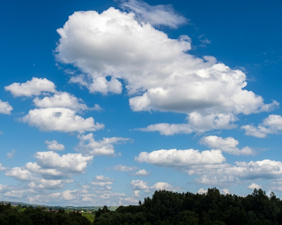
Cumulus
The cumulus cloud is often used as the symbol of all clouds, whether as the first cloud to be drawn by school children or through its use as an animation on weather maps. Its fluffy, bulbous top and flat base define this cloud type.
In sunlight, they appear brilliant white, with cauliflower-like bulges and rising mounds developing in a vertical direction. The base of the cumulus cloud is often dark.
Cumulus clouds develop due to the sun heating the ground directly below using diurnal convection. Due to their appearance on mostly sunny days, they are often referred to as ‘fair weather’ cumulus or clouds. They typically appear late in the morning, grow and change before disappearing as the day draws to a close.
Stratus
The stratus is generally a uniform layer of grey cloud, appearing low in the sky and resembling mist or fog on the horizon. When a stratus cloud is thick enough, drizzle, or snow grains could be produced, but where thin enough, the sun's outline may be clearly visible.
While a feature of dull overcast days, the stratus cloud can often break to reveal blue sky.
Stratocumulus
From the ground, the stratocumulus cloud can often have a honeycomb appearance due to the dark tessellations of its patchwork layers. In many ways, they can appear as if a cumulus cloud has been spread across the sky, characterised by their low, puffy grey or white cloud patches with glimpses of blue sky in between.
Formed due to weak convection in the atmosphere, they are a common feature of mostly bright, cloudy days.
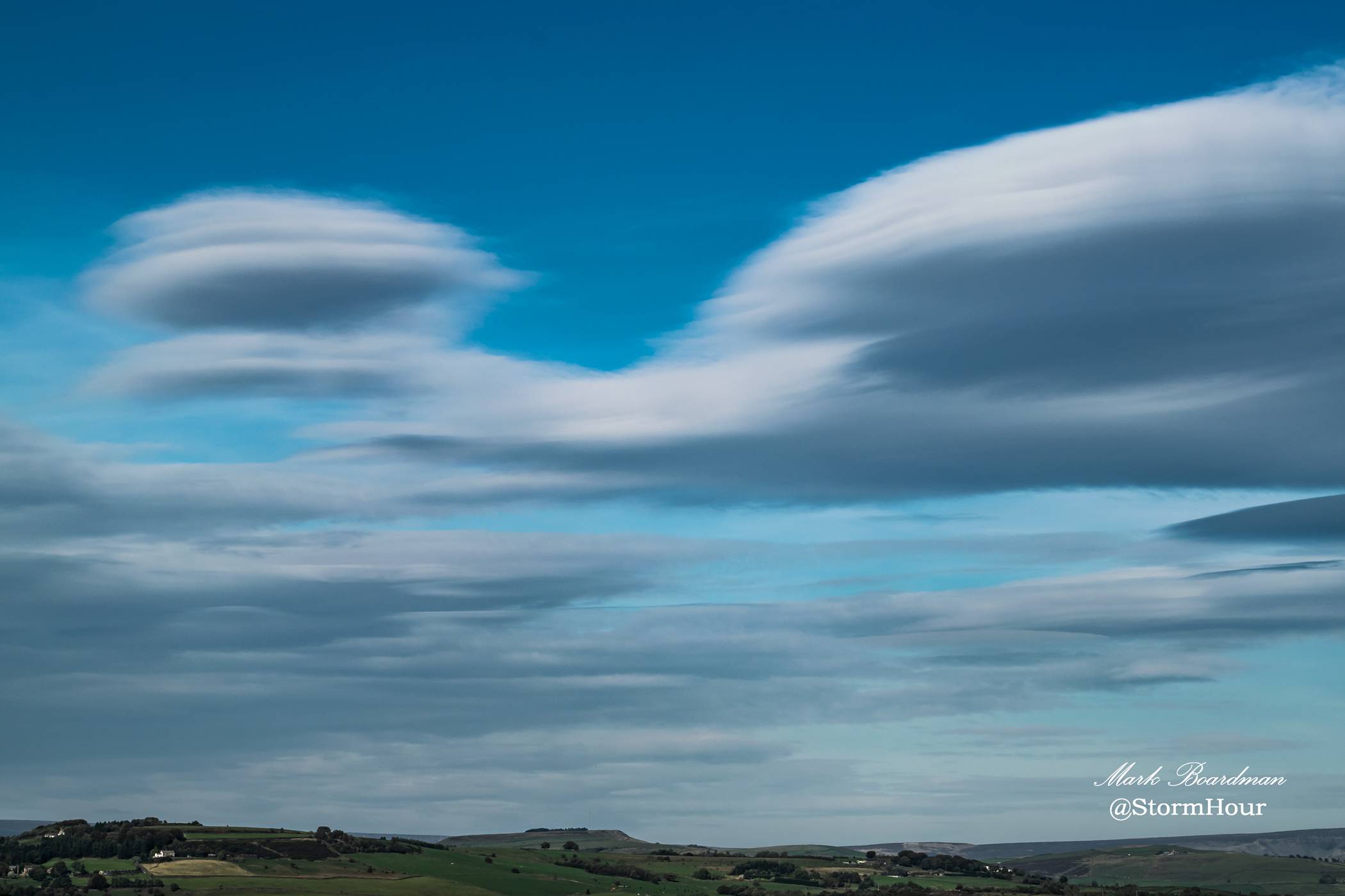
Altocumulus
As the most common cloud of the middle atmosphere, you’ll easily recognise altocumulus clouds as white or grey patches dotting across the sky in rounded masses and rolls. They are often in parallel bands and can have a cotton wool appearance – in fact, they’re sometimes referred to as “sheep backs”.
Typically a feature on summer's warm, humid mornings, the altocumulus cloud can signal an impending thunderstorm. Altocumulus clouds can also signify an approaching cold front or a return to cooler temperatures after a spell of significant warmth or heat.
The stratocumulus and altocumulus clouds are commonly mistaken for one another. While altocumulus clouds are much higher in the sky, we have a handy tip for you to be able to tell the difference. Place your hand up to the sky and measure the size of the cloud against your thumb – if it fits, it’s altocumulus. If the cloud is more fist-sized, it’s most likely stratocumulus.
Nimbostratus
These thick clouds are dark and grey, extending from the atmosphere's low and middle layers. Their density is enough to block the sun and is regarded as the ‘continuous rain cloud’. A feature on those long, dark rainy days, you’ll sometimes see the cloud base lower into the low level of cloud as rain or snow continues to fall across a widespread area.
Altostratus
These grey or blue-tinged sheets of cloud can either totally or partially cover the sky at mid-level, sometimes leaving the sun dimly visible.
Usually appearing ahead of a warm front, the altostratus can also be seen alongside cumulus clouds during a cold front. The altostratus does not produce the halo phenomenon but may occasionally accompany light precipitation.
Cirrocumulus
Cirrocumulus clouds are generally arranged in rows at high altitudes. These small, patchy clouds are made up of ice crystals and the individual mounds are much smaller than their altocumulus and stratocumulus counterparts. Cirrocumulus clouds are often a degraded state of cirrus and cirrostratus clouds and blue sky is generally visible behind.
These clouds don’t hang around for long, so you’ll have to catch a glimpse quickly. They usually feature fair weather days with plenty of intermittent sunshine.
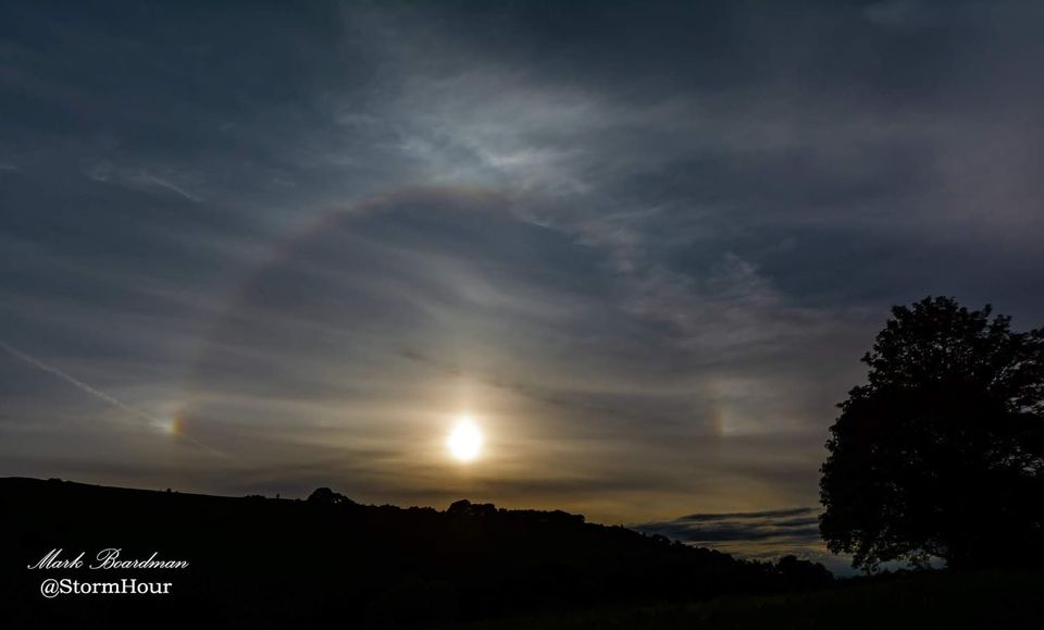
Cirrostratus
The cirrostratus cloud is a whitish, transparent cloud that veils the entire sky. You’ll sometimes see a halo or circle of light around the sun or moon, highlighting the reflection of light on the moisture-filled air. The cirrostratus clouds are a symbol of an approaching warm front.
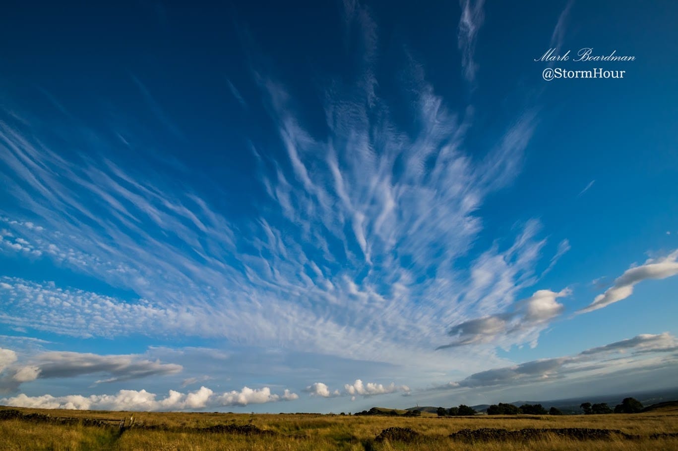
Cirrus
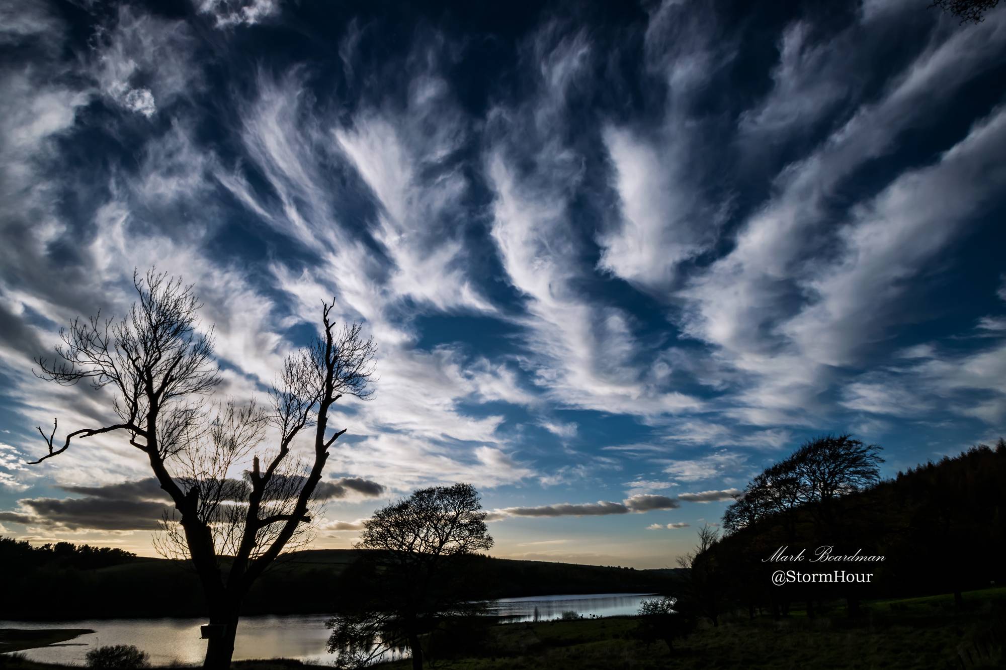
These clouds are one of the easiest to identify. As their name suggests, cirrus (Latin for ‘curl of hair’) clouds are detached, wispy strands across the sky. The cirrus cloud generally appears above an altitude of 20,000ft due to the low temperatures and low water vapour.
Also known as ‘mare’s tails’, cirrus clouds are made up of ice crystals rather than water droplets. Often appearing on fair weather days, these clouds appear ahead of warm fronts or large storms such as a tropical cyclone. They often appear in bright yellow or red tones before sunrise and after sunset, creating spectacular and rapidly changing shapes and formations in the sky.
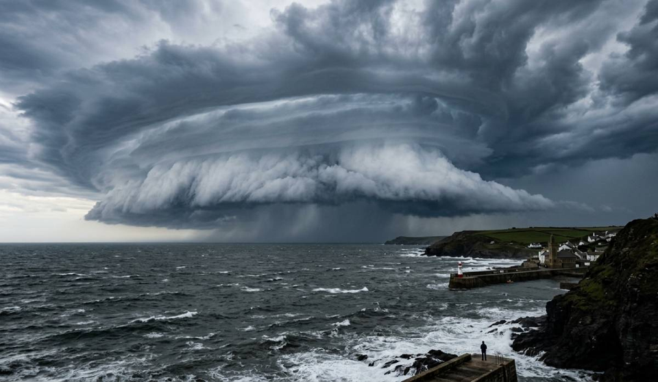
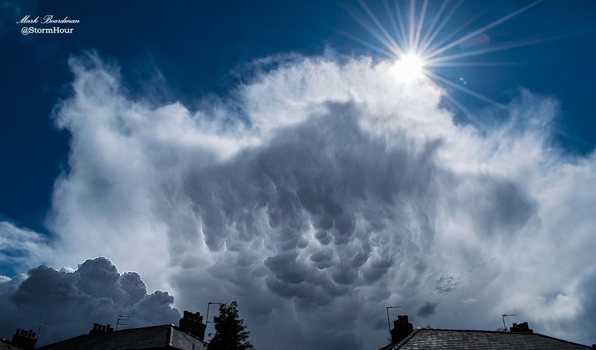
Cumulonimbus
Regarded as the ‘thunderstorm cloud’, the cumulonimbus cloud is generally associated with stormy weather, hail and tornadoes. The cumulonimbus cloud spans the low, middle and high layers and is one of very few to do so.
Generally similar in appearance to cumulus clouds, the cumulonimbus will rise into huge towering peaks, generally flattened in the shape of an anvil or huge plume. The base of these clouds will usually be very dark, with low, ragged clouds making an appearance from time to time.